
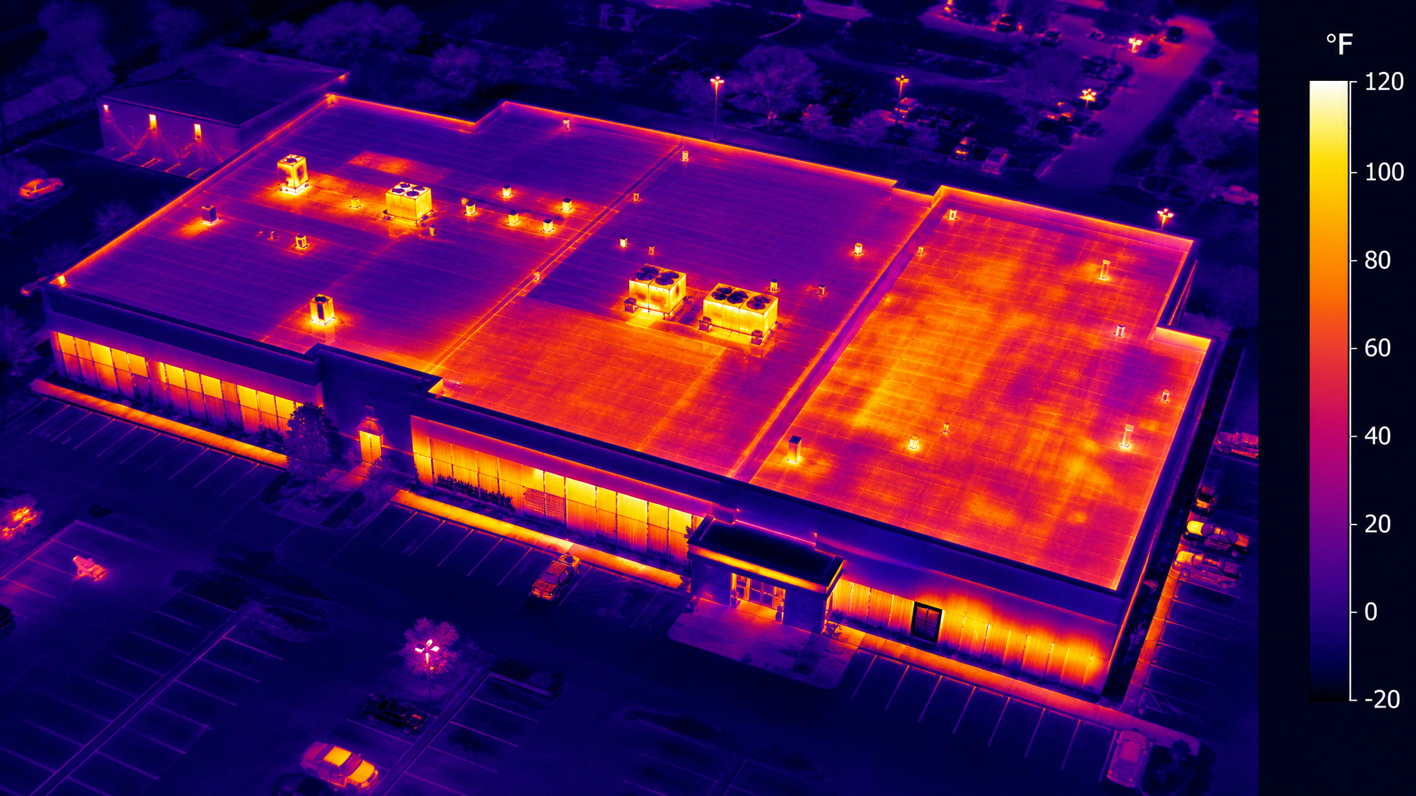
Thermal & Infrared Imaging in North Texas
NorthStar Drone Co. provides advanced thermal and infrared imaging throughout North Texas. Our radiometric FLIR sensors reveal what the eye cannot — heat loss, trapped moisture, electrical hot spots, and hidden structural anomalies — across facilities in the Dallas–Fort Worth metroplex.
Drone Thermal Imaging & Infrared Inspections in North Texas
Temperature tells a story. A wet roof membrane, a failing electrical connection, or an under-performing solar array all show up clearly in thermal imagery long before they cause a costly failure. Our drones scan large roofs, substations, and solar farms across Dallas and Fort Worth safely from the air, with no need for crews to walk energized or fragile surfaces.
ASTM-Compliant Reporting for Insurance & Engineering
We deliver radiometric imagery with full temperature data and clear, documented reports suitable for insurance claims, engineering review, and preventive-maintenance programs. Anomalies are annotated, located, and prioritized so your team knows exactly where to act.
Serving Facilities & Property Owners Across Texas
From commercial roofing and solar operators to electrical utilities and property managers, clients throughout Dallas County, Tarrant County, Denton County, Collin County and Wise County rely on NorthStar thermal inspections to protect their assets and avoid unplanned downtime.
Why Choose NorthStar
- Radiometric FLIR sensors with full temperature data
- Detect moisture, heat loss and electrical faults early
- ASTM-compliant, documented reporting
- Safe, no-contact inspection of energized or fragile assets
- Fast coverage of large roofs and solar arrays
- Local North Texas response
Common Applications
- Commercial roof moisture surveys
- Solar panel and PV array inspections
- Electrical substation and equipment scans
- Building envelope and energy audits
- Mechanical and industrial equipment monitoring
- Insurance claim documentation
Thermal Imaging Pricing in North Texas
Pricing varies by project scope and site conditions. Contact us for a precise, no-obligation quote.
Serving All of North Texas
We provide thermal imaging services across the Dallas–Fort Worth metroplex and surrounding communities.
Frequently Asked Questions
What can drone thermal imaging detect?
It reveals heat loss, moisture intrusion under roof membranes, electrical hot spots, failing solar cells, and insulation gaps — issues invisible to the naked eye.
Do you provide reports for insurance in Texas?
Yes. We deliver ASTM-compliant radiometric reports with annotated, geo-located anomalies suitable for insurance and engineering use.
When is the best time to fly a thermal survey?
Timing depends on the target — roof moisture surveys are often best around sunset, while electrical scans are done under load. We plan each flight for optimal thermal contrast.
Explore More Services
Ready to Get Started in North Texas?
Contact NorthStar Drone Co. today for professional thermal & infrared imaging services across North Texas. Fast scheduling, licensed pilots, and data you can trust.